Thursday, December 20, 2018
Agua Fria Bridge Tragedy
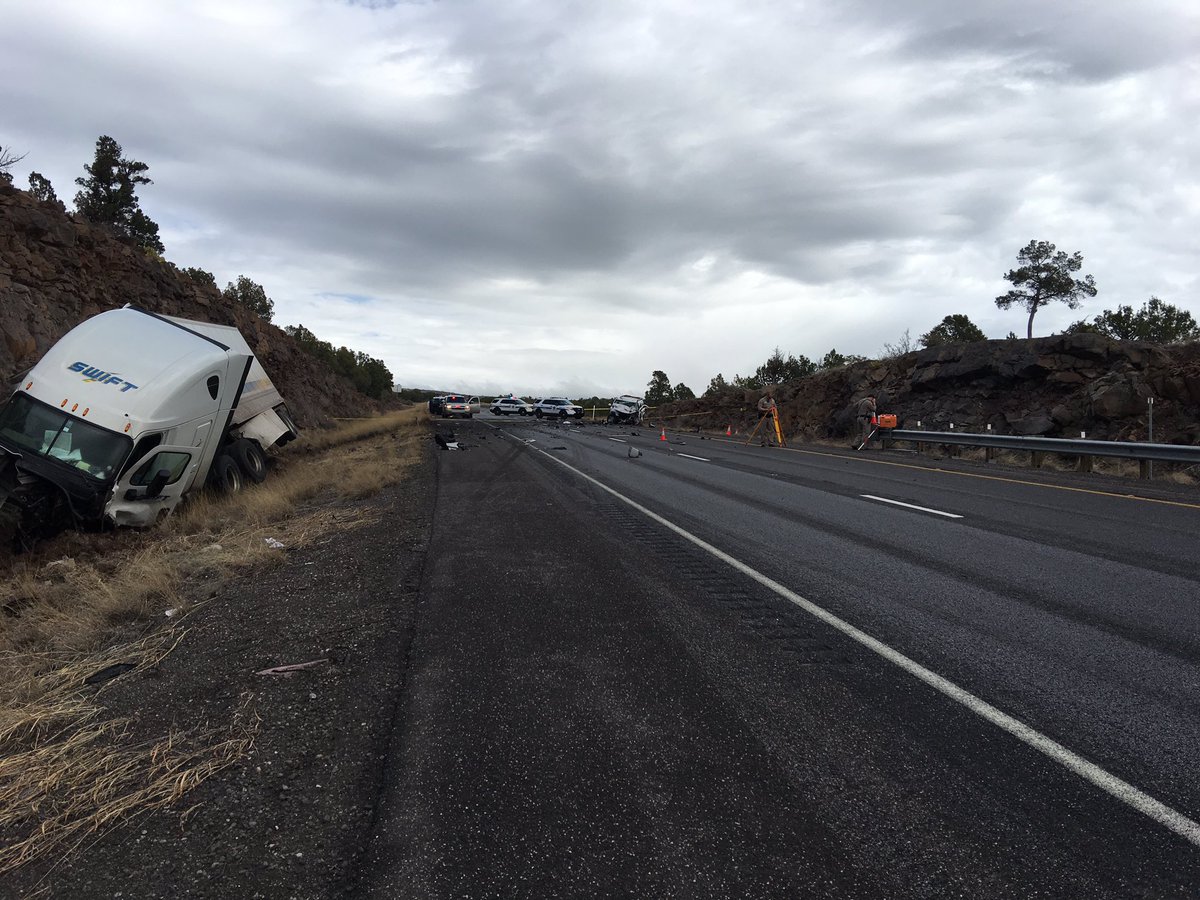
Tragedy struck on The Agua Fria River Monday, December 18, 1978, when both I-17's north and southbound spans collapsed into the raging desert torrent at Black Canyon City, Arizona. Five people died when two vehicles plunged into the swift, chocolate waters.
We've decided to dig deep back into one of I-17's worst natural disasters. More questions remain than have been answered. Over 39 years later, available details are few and far between.
We found this partial account from The December 20th edition of "The Arizona Republic":
"Highway patrolman Chuck Torrey was in Black Canyon City Monday night when he heard a citizens band radio report that the bridge was shifting. "I went to the southbound side of the bridge and the bridge was falling apart by the time I got to it. There were several cars on the southbound side and two cars on the northbound side," he said. "About that time the bridge dropped down about six feet." he said. The 34-year-old patrolman attempted to throw a tow strap to a trapped occupant in one of the cars. "But the bridge started to come down and I jumped in my car, threw it in reverse and got out because the road beneath me was crumbling," the officer said. Torrey said the bridge made "a deep groaning sound and metal was twisting." He said after he backed up, another patrolman had arrived on the opposite side of the collapsed bridge and the two officers blocked it off. When the bridge finally collapsed, he said, the missing woman was out of her car and both she and the vehicle were plunged into the river. The car, a late model El Camino pickup, was located about a quarter-mile from the bridge. The top of the pickup had been sheared off. State engineers said the river washed away cobbles and boulders that supported the $2-million twin span. The flood "scoured out" the material beneath the south abutments, dropping it down and pushing it sideways. Sam Lanford, an engineer with the state Department of Transportation, said "there was certainly nothing wrong with the bridge's structure. It just gave way to nature." When the south end of the bridge dropped shortly before midnight Monday, the force of the stream came to bear on the rest of the superstructure, pushing it off its supports. The south and northbound portions of the 450-foot bridge fell apart as the river purged its banks."
"Tuesday were searching for up to five persons believed to have been swept down the rampaging Agua Fria River after the bridge on Interstate 17 collapsed. One car driven by 40-year-old Jeri Lee E. Griffith of Sedona was found submerged in the river about 9 a.m. Tuesday. Efforts to find the woman were unsuccessful by nightfall. Authorities also said a late-model Pontiac station wagon may have fallen into the river with four members of a Phoenix family inside. Authorities would not identify the four immediately. "All I can say is that a party of four is overdue on their arrival in Phoenix," said Department of Public Safety Lt. F.J. Avars. "They were expected by certain people who arrived in Phoenix late Monday night." "Our next step is to wait for the water to drop." Ayars said. "If it clears up we can get into a ground search maybe within a couple of days." Ayars said the Griffith woman was traveling to Phoenix to pick up her husband, Paul, at Sky Harbor International Airport. The missing Phoenix family had attended a church revival Monday night in Sedona and was to have returned to Phoenix on 1-17."
I-17's twin 422-foot spans over The Agua Fria River were constructed in 1960. Documentation is yet to be found of the engineering of those bridges 57 years ago. In any event, Arizona entered a protracted "wet cycle" in late 1978. The United States Geological Survey produced a 150 page report on the storm events from November 1978 to March 1979 with particular emphasis on the December 16-18 episode.
Although the term "atmospheric river" did not come into weather lexicon until the 1990's, all evidence points to a prolonged, highly-amplified series of atmospheric rivers that washed into Arizona during that time period.
The atmospheric river that hit Arizona the week before Christmas 1978 was particularly intense, producing historic flooding on many of Arizona's creeks, streams and rivers. Although a figure of 60,000 cfs has been bandied about with regard to the failure of the Agua Fria Bridges, the flow was probably more in the 30,000-32,000 range.
Confusion about the flow stems from the fact that the Agua Fria Rock Springs gage is widely cited for "the" flow for the event. The Agua Fria Rock Springs gage is located quite some distance downriver from I-17. This gage logged a max flow of 52,800 on December 18, 1978. However, Black Canyon Creek logged a peak flow of 22,300 on December 18. Black Canyon Creek joins the Agua Fria well downriver from the I-17 bridge site. Moreover, the Bradshaw Mtns. were hit heavily by the storm while the mainstem area of the Agua Fria was not.
It appears that the engineering decision to anchor bridge pier footing on relatively unstable conglomerate was the primary cause of the ultimate failure of the twin spans.
(Editor's Note added 12/20/18: Due to the discontinuation of our I-17 website effort, it is unlikely that most, if not all, of the objectives below will remain undone.)
We are going to be digging into this story for the foreseeable future. We have many objectives for this story.
First and foremost, we would like to Memorialize the victims of this highway disaster. They all deserve at least that much. We've always wondered why there isn't a plaque of some sort located beside that bridge to memorialize those innocent victims.
Second, we intend to delve into ADOT archives and see what we can dredge up on this topic. We have NO idea whether we will be able to find anything in ADOT archives but we're going to give it the good old college try.
Third, we'd like to find the Highway Patrolman who responded and made such a gallant effort to save one of the victims. He's undoubtedly retired by now and we hope he is still with us and willing to talk.
Fourth, we will take a look at how the current spans are faring with the bridge safety index.
Fifth, we'd like to find one or more weather experts to discuss if and how such a repeat incident might happen once again.
Sixth, we'd like to obtain some possible validation of our theory that atmopsheric rivers were responsible for Arizona's devastating weather pattern in that epic, historical November 1978-March 1979 time period.
Finally, we plan to visit the site and walk around and take photos and reflect on this tragedy. People take highways for granted. Highways are to a large degree considered a haven of safety. You expect that you keep driving and you will get to your destination. When the pavement (and your world) falls out from beneath you, it is one of life's truly rudest of shocks...and often very fatal.
As a footnote, here is how the storm pattern was described for the December 16-18, 1978 event:
(From Page 13 of the USGS Report cited above)
"The heaviest and most extensive rainfall of the study period occurred during December 17-20. Total precipitation during this period ranged from less than 1 inch in northeastern and southwestern Arizona to about 10 inches in the Mazatzal Mountains northeast of Phoenix.
The U S Environmental Data and Information Service (1979h) described the storm as follows:
"Several days before the onset of this storm on the night of December 16, an upper low was meandering over the eastern Pacific near 27 °N [latitude] and 133 °W [longitude] This cutoff low developed several days previously from an eastern Pacific trough. The north portion of the trough moved eastward and a strong zonal flow was established across the northeastern Pacific, much of the United States, and southern Canada. The air in these westerlies [winds moving from the west] was quite dry Arizona, likewise was dry. As the upper low continued to meander, moisture began to increase over the southwestern United States. Satellite imagery from December 14 through 17 showed a large mass of cloudiness stretching from Baja [Mexico], southwestward. The flow across the Baja Peninsula and southern California was still anticyclonic, and all cloudiness streaming into Arizona from the southwest was cirriform [high thin clouds]
By Friday, December 15, 1t was evident that a short-wave trough was intensifying near 170 °W. Within 24 hours this developed into a moderately strong trough in the Gulf of Alaska near 140 °W. By OOZ Sunday, December 17 [1400 hours December 16 MST], the trough had deepened, moved to 133 °W, and absorbed the low-latitude low, [thus] forming a large amplitude quasi-stationary trough. The trough continued to deepen while remaining nearly stationary. As the upper portion of the trough moved eastward, the lower portion remained between
120°-130°W, from Sunday morning, December 17, to Tuesday morning, December 19. At the same time, a short wave rotated out of the long-wave trough, resulting m a steady flow of nearly saturated air from the southwest into Arizona. Cloudiness over Arizona thickened rapidly Saturday night as the flow backed from west-southwest of southwest. Rain began over most of Arizona before dawn Sunday and gradually increased in intensity The most intense rains were Sunday night and Monday morning, decreasing slowly until they were virtually over by Wednesday morning [December 20]. As the heavy flow of moist tropical air encountered mountain ranges, such as the Bradshaw, Mazatzal, and Sierra Ancha Mountains and the Mogollon Rim, large amounts of precipitation occurred because of the orographic uplift. Rainfall intensities were moderate to high but in themselves were not responsible for the high runoff. Few, if any, extreme intensities of short duration occurred during this storm, but rates of 0 .25 to 0.5 inch./hr were common throughout the foothills and mountainous areas of central Arizona on December 17 and 18, 1978."
Sources:
The USGS Report: https://pubs.usgs.gov/wsp/2241/report.pdf
Note that the page numbering is weird. We're using your PDF Reader's page number. It may or may not agree with "actual" page numbering.
Source of the photos: http://azsce.org/downloads/The%20High%20and%20Low%20of%20Engineering%20Options.pdf
Source of the newspaper quotes:
https://www.newspapers.com/newspage/119609355/
Acknowledgements: Many Thanks to the Phoenix National Weather Service Office Staff for their gracious assistance in sourcing the USGS report. Thanks also to Salt River Project Staff for their valuable insights.
Friday, November 30, 2018
Wild West on I-17
![]() |
Using this FOX10 photo, we have been able it better identify the location of the wrong-way crash. Scroll through post. |
We're signing off now and this is our final comment. Remember that "Just Another Day on I-17" has a whole new meaning, right? Good Night & Many Cheers, jp)
(Editor's Note: An updated ABC15 News report updated about 2:30 PM indicates that the collision may not have been fatal, contrary to earlier report. See excerpt at end of this post with source link.)
A carjacking. Shots fired at DPS Officers. A high speed chase. A wrong way driver. A head on collision. That's the general outline of what we know about today's dramatic events on I-17.
As of 10:30 AM, the southbound lanes of I-17 were closed and would not reopen for many hours. Meanwhile, as everyone knows, "Southbound Sunday" turned into a classic I-17 nightmare. Traffic that hasn't already been caught in the closure has been diverted to either 89A or a really, really long detour to Highways 87 and 260.
Meanwhile, ADOT said traffic backed up 7-8 miles on 89A north of Sedona. That distance is well north of Slide Rock State Park.
This blog post will be evolving over the next few hours until the southbound lanes reopen. We will attempt to find out as much as possible about the events leading up to the crash that closed the highway. Details are few and far between. We will attempt to "source" each of our updates. Your best source of accurate, up-to-the-minute information is the ADOT Twitter account:
At 1:54 PM, DPS Tweeted these photos and said, "Our detectives, troopers & Yavapai Co. deputies are investigating two crime scenes southbound along #I17 between Munds Park & Camp Verde. (Source: https://twitter.com/Arizona_DPS)
Confusion exists as to the exact location of the crash. Some reports indicated Milepost 308 or 307 and some say Milepost 317. We're certain the crash took place near Milepost 307 for several reasons: 1) AZ DPS Col. Frank Milstead uses MP 307 in his Tweets; 2) The FOX10 photo at the top of this post shows the crash in an area that we personally well know; and 3) Milepost 307 is one mile north of the Stoneman Lake Road exit and the vegetation is a pinon-juniper forest. At Milepost 317, the vegetation is a Ponderosa Pine forest. Meanwhile I-17 is closed at Milepost 317 which is the Munds Park exit. That's probably how the confusion arose about the location of the crash.
It is clear that the southbound lanes will be closed for an extended period while officials investigate, document, record and clear the scene.
The story apparently began about 9 AM Sunday and we are working to find and list sources about the earlier events.
The first Tweet that we can find about today's event is time stamped 9:18 AM.
A subsequent identical Tweet from Col. Milstead's account is time-stamped 10:18 AM. Meanwhile, the most recent Tweet from Col. Milstead's account is time-stamped 10:35 and indicates there was a "fatal collision".
Meanwhile, limited alternate routes are available to avoid the southbound snarl. Traffic is backed up for many miles in Oak Creek Canyon, possibly as far north as nearly to Slide Rock State Park. As everyone knows Southbound Sundays are typically the busiest and most congested on I-17 between Flagstaff and The Valley. Most of the visitors to The High Country are returning home on Sunday afternoon.
Most credible reports indicate the crash too place at Milepost 307. The FOX10 photo at the top of this post shows an area with which we are very familiar that is located perhaps 150-200 yard north of where I-17 crosses Rattlesnake Canyon about a mile north of the Stoneman Lake Road exit. Rattlesnake is a tributary of Woods Canyon which then becomes Dry Beaver Creek when it flows under Highway 179 between I-17 and the Village of Oak Creek.
ABC15 News has this report updated at about 2:30 PM. http://www.abc15.com/news/region-northern-az/flagstaff/i-17-closed-southbound-near-munds-park-for-deadly-crash-and-shooting-involving-carjacking-suspect
Drivers and passengers stuck in this snarl need to remind themselves that what happened isn't "just a crash". Nope. It's a "Crime Scene" and there are huge differences in how DPS Officers are required to handle a normal crash versus a crime scene.
We're getting a little bit better idea of the timing of this incident. The AZFAMILY article linked here indicates the carjacking probably took place AFTER 10 AM since reports of reckless driving were coming in before 10 AM as per the article. The news report states, "Authorities said they began getting reports of a vehicle driving recklessly southbound along I-17 north of Camp Verde just before 10 a.m." The head on crash is said to have taken place "around 10:20 AM". http://www.azfamily.com/story/34484727/dps-carjacking-suspect-fires-at-troopers-ends-in-fatal-crash Flag Scanner copied and posted an MP3 audio file of the Dispatcher's communication during the chase and crash. It appears the Mustang was driven south on I-17 to around around Milepost 291 and then North in the correct lanes to Stoneman Lake Road. It was here that the Mustang then crossed into the Southbound lanes. Scrolll through Flag scanner's post until you see the link shown by the arrow in the screen clip below. Get some headphones. https://www.facebook.com/photo.php?fbid=754752111354724&set=a.100448770118398.974.100004598250156&type=3
Here's a copy of the ADOT Tweet announcing the road reopening. Notice the time stamp of 8:10 PM.
A subsequent identical Tweet from Col. Milstead's account is time-stamped 10:18 AM. Meanwhile, the most recent Tweet from Col. Milstead's account is time-stamped 10:35 and indicates there was a "fatal collision".
Meanwhile, limited alternate routes are available to avoid the southbound snarl. Traffic is backed up for many miles in Oak Creek Canyon, possibly as far north as nearly to Slide Rock State Park. As everyone knows Southbound Sundays are typically the busiest and most congested on I-17 between Flagstaff and The Valley. Most of the visitors to The High Country are returning home on Sunday afternoon.
ABC15 News has this report updated at about 2:30 PM. http://www.abc15.com/news/region-northern-az/flagstaff/i-17-closed-southbound-near-munds-park-for-deadly-crash-and-shooting-involving-carjacking-suspect
"DPS says there were reports of a red Mustang driving recklessly southbound on I-17 north of Camp Verde just before 10 a.m. The car crashed with a vehicle, and the driver of the Mustang got out and took a white GMC SUV from the crash scene at the point of a rifle.
The suspect fired at troopers pursuing the stolen SUV, DPS said, but no one was injured by the gunshots.
The stolen SUV crashed head-on into a semi in the southbound lanes of I-17 about 15 miles south of Munds Park, according to a DPS spokesperson.
The suspect was airlifted from the scene with life-threatening injuries. DPS said the suspect remained alive as of Sunday afternoon, correcting earlier information provided by Col. Frank Milstead that the suspect had died in the crash.
The driver of the semi was not severely hurt, DPS said.
According to Col. Milstead, no troopers were injured in the incident."
The confusion about the Milepost of the crash may have come from media use of the Milepost of the actual closure of I-17. I-17 is closed at Milepost 317 which is the Munds Park exit. Apparently, semi-trucks either can't or have chosen not to turn around at that exit so they are backed up alongside I-17.
We just received a report from a Dear Friend we trust 100%. She was returning from Sedona to Rimrock via I-17 shortly after 1 PM. After getting on I-17 at the Sedona exit, she passed police activity in the Southbound lanes at a point north of the McGuireville Rest Area. She reported seeing a red Mustang with a crashed front and a truck showing rear collision damage.
This would be consistent with the DPS report about investigating two crime scenes on I-17 Southbound. Based on information gleaned from the ABC15 report, this may have been the point where the carjacking took place.
It remains to be revealed what happened after the Tahoe was carjacked. Did it travel south and then turn around? Or did it go north in the southbound lanes from the point of carjacking? Where were the shots fired at DPS Officers? Many questions remain.
The ABC15 News reports attributes DPS as saying, "the driver of the Mustang got out and took a white GMC SUV from the crash scene at the point of a rifle."
Note that in the FOX10 News photo, a DPS Officer is carrying two AR-15 rifles away from the crashed GMC SUV. Was one of these rifles used in the carjacking?
Typically DPS will issue most known facts of an incident within 24 hours of its occurrence. We will add official information when it is released.
Below is just a mere glimpse of the standstill snarl at Munds Park and points north. Photo credit: Mike Schmidt, 3TV/CBS 5The confusion about the Milepost of the crash may have come from media use of the Milepost of the actual closure of I-17. I-17 is closed at Milepost 317 which is the Munds Park exit. Apparently, semi-trucks either can't or have chosen not to turn around at that exit so they are backed up alongside I-17.
This would be consistent with the DPS report about investigating two crime scenes on I-17 Southbound. Based on information gleaned from the ABC15 report, this may have been the point where the carjacking took place.
It remains to be revealed what happened after the Tahoe was carjacked. Did it travel south and then turn around? Or did it go north in the southbound lanes from the point of carjacking? Where were the shots fired at DPS Officers? Many questions remain.
The ABC15 News reports attributes DPS as saying, "the driver of the Mustang got out and took a white GMC SUV from the crash scene at the point of a rifle."
Note that in the FOX10 News photo, a DPS Officer is carrying two AR-15 rifles away from the crashed GMC SUV. Was one of these rifles used in the carjacking?
Typically DPS will issue most known facts of an incident within 24 hours of its occurrence. We will add official information when it is released.
Drivers and passengers stuck in this snarl need to remind themselves that what happened isn't "just a crash". Nope. It's a "Crime Scene" and there are huge differences in how DPS Officers are required to handle a normal crash versus a crime scene.
We're getting a little bit better idea of the timing of this incident. The AZFAMILY article linked here indicates the carjacking probably took place AFTER 10 AM since reports of reckless driving were coming in before 10 AM as per the article. The news report states, "Authorities said they began getting reports of a vehicle driving recklessly southbound along I-17 north of Camp Verde just before 10 a.m." The head on crash is said to have taken place "around 10:20 AM". http://www.azfamily.com/story/34484727/dps-carjacking-suspect-fires-at-troopers-ends-in-fatal-crash Flag Scanner copied and posted an MP3 audio file of the Dispatcher's communication during the chase and crash. It appears the Mustang was driven south on I-17 to around around Milepost 291 and then North in the correct lanes to Stoneman Lake Road. It was here that the Mustang then crossed into the Southbound lanes. Scrolll through Flag scanner's post until you see the link shown by the arrow in the screen clip below. Get some headphones. https://www.facebook.com/photo.php?fbid=754752111354724&set=a.100448770118398.974.100004598250156&type=3
Here's a copy of the ADOT Tweet announcing the road reopening. Notice the time stamp of 8:10 PM.
Monday, August 6, 2018
1-17 South Point of Beginning
The southern end of I-17 begins where 24th Street goes under The Maricopa Freeway near the far southwest corner of Sky Harbor Airport. Technically, I-17's POB (Point Of Beginning) is Milepost 193.89 but there is no sign marking the highway's actual POB. The sign at I-17's POB is actually Milepost 150 for I-10.
"I-17 has the unusual distinction of starting at approximately milepost 193.89 instead of at milepost zero. This is a holdover from Arizona's old system of marking mileposts, where a branching route would continue the milepost numbering of its original host, instead of starting over at zero. Interstate 17 inherited its milepost locations from SR 69, which the freeway replaced between Phoenix and Cordes Junction. SR 69's mileposting was such that it coincided with US 89's mileposting, which was 201.6 where the two routes intersected. When I-17 was constructed, the existing mileposting for SR 69 was retained." (Source 1)
We were able to learn of I-17's precise southern POB by studying an ADOT Right-Of-Way document. the key information is shown above. It appears from the ADOT document that the west edge of the 24th Street alignment is actually the true POB for I-17 but it may actually be the centerline of 24th Street. We are attempting to clarify that very minor fine point. (Source 2)
Above is the very nondescript spot on 24th Street where I-17 begins on the overpass deck above. We visited this site at 8:30 AM, January 4, 2017.
For anyone wishing to visit I-17's southern POB, we recommend parking in the Best Western motel lot a short distance south of The Maricopa Freeway. (See "A" in above photo.) There is a safe sidewalk on the west side of 24th Street. Proceed under the Maricopa and then climb the north embankment of the freeway. (See "B" in above photo.) Stay well outside the guardrail for your safety.
The I-17 sign above appears to be the first actual I-17 marker. The location is actually rather picturesque. It is adjacent to the landing pattern of one of the 3000-acre Sky Harbor Airport's busy runways. The site also affords a nice distant view of downtown Phoenix and a stand of nearby mature palm trees add to the interstate highway ambiance. Abundant urban photo ops abound.
Our next project will be to visit and document the northern end of I-17 in Flagstaff.
"I-17 has the unusual distinction of starting at approximately milepost 193.89 instead of at milepost zero. This is a holdover from Arizona's old system of marking mileposts, where a branching route would continue the milepost numbering of its original host, instead of starting over at zero. Interstate 17 inherited its milepost locations from SR 69, which the freeway replaced between Phoenix and Cordes Junction. SR 69's mileposting was such that it coincided with US 89's mileposting, which was 201.6 where the two routes intersected. When I-17 was constructed, the existing mileposting for SR 69 was retained." (Source 1)
Above is the very nondescript spot on 24th Street where I-17 begins on the overpass deck above. We visited this site at 8:30 AM, January 4, 2017.
For anyone wishing to visit I-17's southern POB, we recommend parking in the Best Western motel lot a short distance south of The Maricopa Freeway. (See "A" in above photo.) There is a safe sidewalk on the west side of 24th Street. Proceed under the Maricopa and then climb the north embankment of the freeway. (See "B" in above photo.) Stay well outside the guardrail for your safety.
The I-17 sign above appears to be the first actual I-17 marker. The location is actually rather picturesque. It is adjacent to the landing pattern of one of the 3000-acre Sky Harbor Airport's busy runways. The site also affords a nice distant view of downtown Phoenix and a stand of nearby mature palm trees add to the interstate highway ambiance. Abundant urban photo ops abound.
Our next project will be to visit and document the northern end of I-17 in Flagstaff.
Subscribe to:
Posts (Atom)